Long before engines made the sea feel smaller, a captain's most valuable knowledge was often invisible: the direction, season and character of the wind. The trade winds and early Atlantic navigation are closely connected because these dependable breezes helped turn the Atlantic from a formidable barrier into a navigable route for exploration, trade and cultural exchange.
For visitors cruising from Tenerife today, the north-easterly breeze can feel like a natural part of the island's rhythm. Yet the same wind system once influenced where ships could travel, when they could leave and how they could return. Understanding that history adds another layer of meaning to time spent on the water around the Canary Islands.
The trade winds are persistent easterly winds found on either side of the Equator. In the North Atlantic, they generally blow from the north-east towards the south-west. Their broad pattern is connected to global atmospheric circulation and the rotation of the Earth.
Sailors did not need modern meteorology to recognise this pattern. Through observation and experience, mariners learned that a ship leaving the Iberian Peninsula could head south towards the Canary Islands and then use the north-easterly trades for a westbound Atlantic crossing.
For vessels that depended entirely on sails, this knowledge was fundamental. The most direct route on a map was not necessarily the fastest or most practical route on the ocean. A successful voyage depended on understanding the relationship between wind, currents, latitude and the condition of the ship.
The trade winds are not identical every day. Their strength and position vary, while local geography can alter conditions considerably. Tenerife's mountains and coastline, for example, influence wind patterns close to the island. Even so, the broader Atlantic circulation was reliable enough to become one of the foundations of long-distance sailing.
The Canary Islands occupy a strategic position off the north-west coast of Africa, within reach of European ports and close to the routes used by early Atlantic sailors. For ships preparing to cross the ocean, the islands provided an opportunity to take on water and food, make repairs, check rigging and wait for favourable conditions.
This was particularly important when a voyage could last for weeks. Fresh water, preserved food, spare sails and sound rigging were essential. The islands also provided access to the wind belt that could carry sailing ships west towards the Caribbean and the Americas.
The Canaries were already inhabited and connected to wider maritime worlds before European expansion intensified. Their later importance in Atlantic navigation brought profound changes to the islands and their people. The history of these routes therefore includes exploration and maritime innovation, but also conquest, colonial expansion and the transatlantic slave trade.
That wider context matters. The Atlantic routes created opportunities for merchants, sailors and European powers, while also becoming part of systems that caused enormous human suffering.
By the fifteenth century, Portuguese and Castilian sailors had developed increasingly sophisticated knowledge of Atlantic wind patterns. They understood that a successful voyage required more than choosing a destination and pointing the ship towards it.
One of the most important principles was the volta do mar, often translated as the "turn of the sea". On return journeys, ships sailing from lower Atlantic latitudes towards Europe could not simply fight their way east against the trade winds. Instead, they could sail north-west towards areas where westerly winds were more favourable before turning east towards the Azores and the European coast.
To a modern traveller, the idea seems counter-intuitive: to get home, a captain might first sail away from home. For sailors working entirely with natural forces, however, it was a practical response to the circulation of the Atlantic.
This growing understanding of wind and current helped transform individual voyages into repeatable routes. Maritime knowledge accumulated over generations became a strategic advantage, allowing ships to plan passages with greater confidence.
| Navigation concept | Wind or current | Historical significance | Relevance today |
|---|---|---|---|
| Westbound trade-wind route | North-east Trade Winds and westward currents | Helped sailing ships cross the Atlantic towards the Caribbean and the Americas. | Trade winds remain an important part of the Atlantic's wind system around the Canary Islands. |
| Volta do mar | North Atlantic westerlies and broader ocean circulation | Allowed returning ships to avoid fighting directly against the trade winds. | Shows how successful navigation depends on working with prevailing conditions. |
| Canary Islands as a provisioning stop | Strategic position within Atlantic wind routes | Ships could take on water and supplies, make repairs and prepare for longer passages. | The islands remain an important maritime gateway between Europe and the Atlantic. |
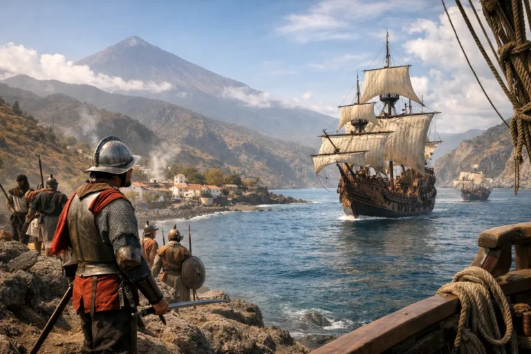
Christopher Columbus's first westbound voyage in 1492 followed a route that made use of the Canary Islands and the north-easterly trade winds. His fleet stopped at La Gomera before beginning the Atlantic crossing.
The significance of the voyage was therefore connected to more than the courage of sailing into the Atlantic. It relied on accumulated knowledge of prevailing winds, currents, latitude and provisioning. The Canaries formed part of the practical route that helped make the westbound crossing possible.
Later voyages repeatedly used similar Atlantic patterns. Once sailors understood how to work with the prevailing circulation, the ocean became increasingly connected by established maritime routes.
Wind alone did not carry a ship across the Atlantic. Captains also had to account for currents, changing weather, sea state, the condition of the vessel and the health of the crew.
The North Equatorial Current generally moves westwards alongside the trade-wind route, providing an additional influence on westbound passages. On return journeys, sailors used a broader combination of northern Atlantic winds and currents to work their way back towards Europe.
Navigation itself remained demanding. Before reliable marine chronometers made longitude calculations much more practical, sailors often relied on dead reckoning to estimate their position from course, speed and elapsed time. The Sun and stars helped determine latitude, while observations of the sea, sky and coastline could provide additional clues.
The early Atlantic was therefore never as predictable as a simple line drawn across a chart. The trade winds offered a powerful advantage, but storms, calms, disease and navigational errors remained serious risks. A capable captain needed technical knowledge, discipline and the judgement to change course when conditions demanded it.
As Atlantic routes became better understood, they connected Europe, West Africa, the Caribbean and the Americas in ways that reshaped economies and societies.
Ships carried people, crops, animals, precious metals, manufactured goods and ideas across enormous distances. They also carried violence and exploitation on a vast scale. Sugar, tobacco, cacao and other commodities became part of an increasingly interconnected Atlantic economy, while enslaved Africans were forcibly transported across the Middle Passage under horrific conditions.
The environmental knowledge that made regular ocean crossings possible therefore became part of much larger systems of trade and empire. The history of early Atlantic navigation is consequently a history of seamanship and technological progress, but also of power and human cost.
The Canary Islands were deeply involved in this changing Atlantic world. Their geographical position gave them strategic importance, while their ports and communities became connected to maritime networks that stretched far beyond the archipelago.
Modern cruising around Tenerife takes place in very different circumstances. A yacht offers modern navigation equipment, reliable weather information and the freedom to enjoy the coastline without the hardships faced by sailors centuries ago.
Yet some fundamentals remain recognisable. Crews still pay close attention to wind direction, swell and local conditions when planning a route. The choice between a sheltered coastal course, open water or a swim stop depends on the weather and the state of the sea on that particular day.
Good seamanship has always involved responding to the conditions rather than forcing a predetermined route. That principle remains relevant today, whether the goal is a comfortable coastal cruise, wildlife watching or simply spending an afternoon on the Atlantic.
For guests interested in experiencing these waters from a private yacht, a private whale watching and relax cruise offers time to explore the coastline while the crew adapts the route to the conditions. The experience combines open-water cruising with the possibility of seeing whales and dolphins, swimming or snorkelling when conditions are suitable.
For those who prefer a smaller shared experience, Royal Ocean also offers a shared whale and dolphin watching cruise departing from Las Galletas. The tour is limited to a small group and includes time for wildlife watching and a swim stop when conditions allow.
From a yacht off Tenerife, the horizon can look wonderfully simple: blue water, clear sky and the possibility of a memorable afternoon. Behind that view lies a long history of people learning to work with the wind rather than against it.
The next time a north-easterly breeze moves across the Canaries, it is worth remembering that this wind system once helped guide wooden ships across one of the world's great oceans. It shaped routes, influenced the rise of Atlantic trade and connected distant parts of the world.
Today, the same Atlantic winds are part of the natural character of Tenerife. Understanding their role in history makes the coastline and the sea around the island feel that little bit more meaningful.
The trade winds are persistent easterly winds found on either side of the Equator. In the North Atlantic, they generally blow from the north-east towards the south-west. Their reliability made them an important foundation of early Atlantic navigation and westbound ocean crossings.
The Canary Islands were strategically located off north-west Africa and close to routes leading from Europe towards the Atlantic. Ships could take on water and supplies, make repairs and prepare for longer westbound passages.
The volta do mar, or "turn of the sea", was a return strategy in which ships first sailed north-west into areas with more favourable westerly winds before turning east towards the Azores and Europe. It allowed sailors to work with the Atlantic's circulation rather than fight directly against the trade winds.
Columbus's first westbound voyage in 1492 used the Canary Islands as part of its route before the Atlantic crossing. The fleet stopped at La Gomera and then used the prevailing north-easterly trade winds to sail west.
Yes. The north-easterly breeze around Tenerife is part of the broader Atlantic wind system. Modern crews still consider wind direction, swell and local conditions when planning comfortable and safe routes around the island.