From the water, Tenerife can feel wonderfully dramatic: dark cliffs rise from a deep blue sea, sheltered coves appear between lava headlands, and black-sand beaches catch the light. Understanding how Tenerife’s volcanic coastline was shaped by the Atlantic adds another dimension to a cruise along the island’s shore.
This coastline was created by volcanic activity and then continuously modified by the ocean. Lava built the land, while waves, wind, salt and erosion have been reshaping its edges ever since.
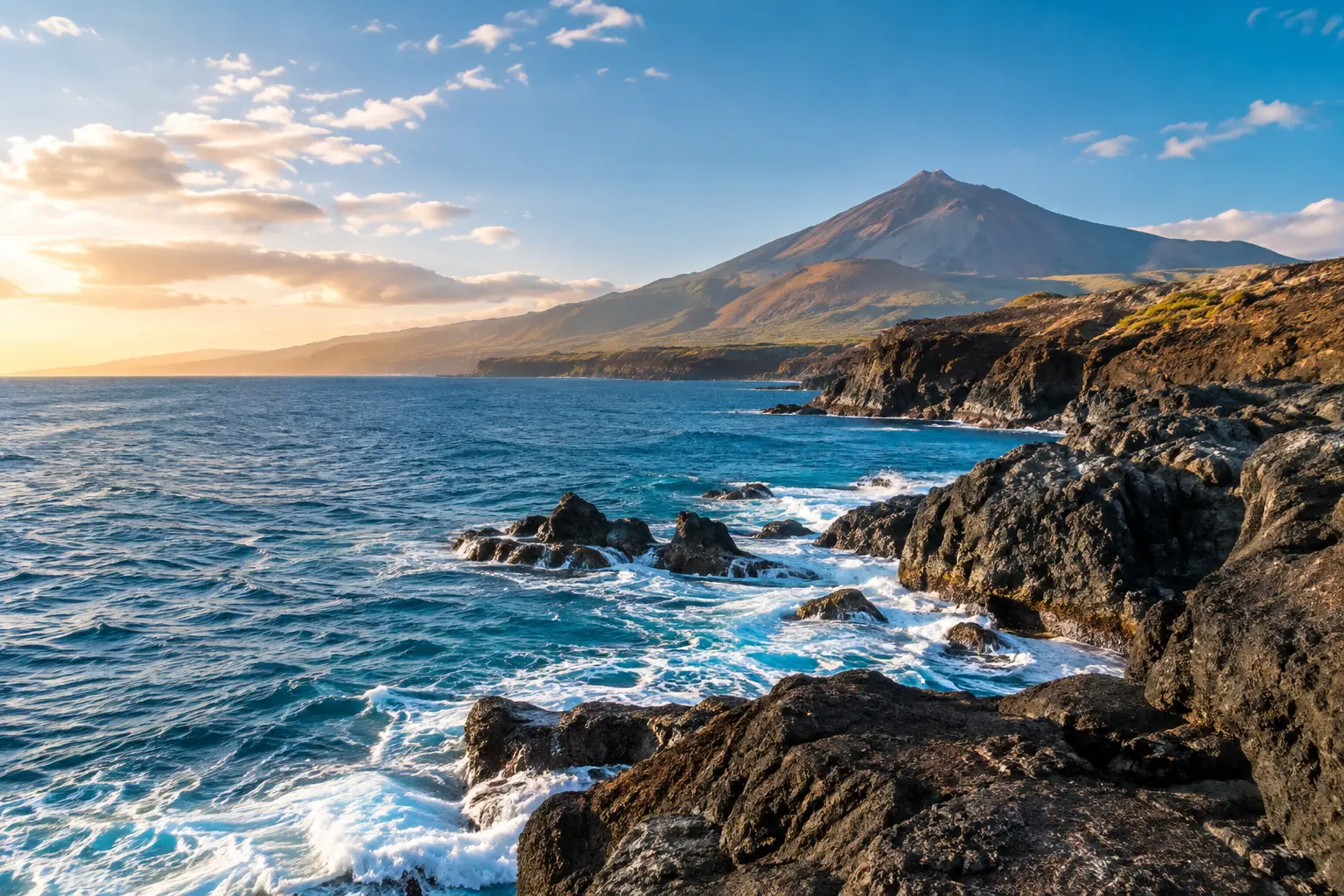
Tenerife was created by volcanic activity over millions of years. Successive eruptions sent lava across older ground and, at times, towards the sea. When hot lava reached the cooler Atlantic, it cooled and hardened into volcanic rock, helping extend the island’s edge.
These processes did not produce a smooth or symmetrical coastline. Different lava flows have different structures and levels of resistance. Some are relatively dense, while others contain fractures or weaker layers that can be attacked more easily by waves.
The Atlantic has had an enormous amount of time to work on these differences. Waves repeatedly strike exposed rock, enter cracks and gradually remove material. Salt, wind and changes in temperature also contribute to the weathering of surfaces exposed to the elements.
The result is the varied coastline Tenerife has today: steep cliffs, broken lava shelves, rocky headlands, small coves and stretches where dark volcanic rock reaches directly into the sea.
Wave erosion is one of the most visible forces shaping the coastline. Where waves repeatedly hit the base of a cliff, they can gradually create recesses in the rock. Over time, weakened sections above may collapse, causing the cliff to retreat.
The process is not equally strong everywhere. The type of volcanic rock, the orientation of the coastline, wave exposure and local conditions all influence how quickly particular sections change.
Over long periods, this produces the stepped and irregular profiles that are characteristic of many parts of Tenerife’s coast.
The private yacht cruise around Tenerife’s southern waters offers a particularly good perspective for seeing these formations from sea level. From the water, you can observe the vertical faces, exposed lava layers and transitions between different coastal formations much more clearly than from many viewpoints on land.
Tenerife’s black beaches are another visible reminder of the island’s volcanic origin. Volcanic rock is gradually broken down by weathering and wave action. Larger fragments can become dark stones, while finer material contributes to volcanic sand.
The Atlantic then moves this material along the coast. Currents and waves transport and redistribute sand and sediment, which means beaches can change shape and appearance over time.
Not all black-sand beaches look the same. Their colour, grain size, shape and exposure depend on the local geology and the processes affecting that particular section of coastline.
Tenerife’s central mountains influence how the island experiences the prevailing trade winds. This contributes to noticeable differences between the northern and southern sides of the island.
The north coast is generally more exposed to Atlantic weather and swell. It is known for a greener, more rugged landscape and can experience more energetic sea conditions.
The south and south-west are commonly more sheltered. This helps explain why the area around southern Tenerife is popular for boat trips, swimming stops and whale and dolphin watching.
Conditions still vary from day to day. Wind direction, swell, tides and local coastal effects all influence what the sea will be like during a particular cruise. A professional crew can adapt the route according to the conditions rather than following a rigid itinerary.
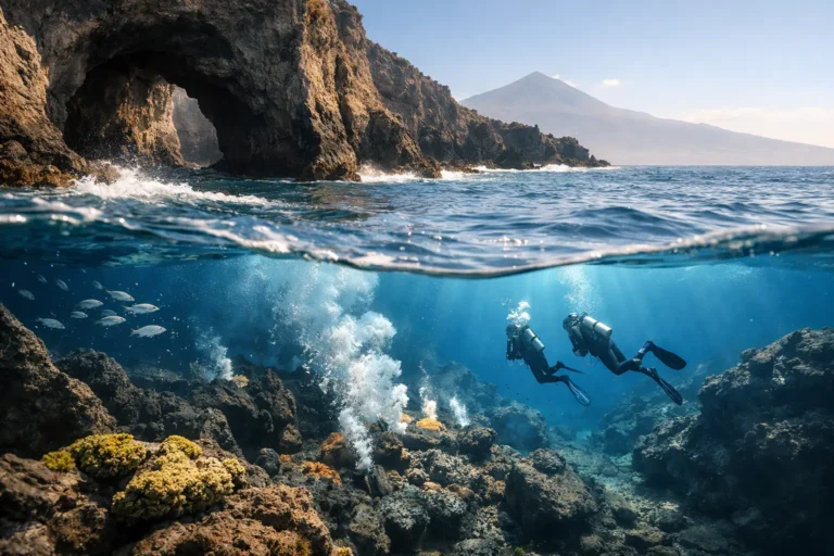
Some of Tenerife’s volcanic structure continues below the surface. Lava shelves, rocky platforms and submerged formations can influence both the appearance and depth of the water close to shore.
In clear conditions, you may see the transition from deep blue water to lighter turquoise or green above shallower volcanic terrain. Around rocky coves, underwater formations can continue the geological patterns visible above the surface.
These areas also require local knowledge. Volcanic coastlines can have sudden changes in depth, uneven seabeds and submerged rocks. Safe navigation and anchoring therefore depend on the exact location and current sea conditions.
This is one of the advantages of travelling with an experienced crew: guests can concentrate on the scenery while the crew handles route planning and navigation.
Few places demonstrate the scale of Tenerife’s volcanic coastline more clearly than Los Gigantes. The huge cliffs rise directly from the Atlantic and reveal the power of geological processes that have shaped the island over very long periods.
Seen from land, the cliffs are already impressive. From the water, their vertical scale becomes easier to appreciate because you can see the rock rising directly from sea level and follow the coastline as it disappears into the distance.
A yacht trip towards Los Gigantes can therefore turn a geological story into something much more tangible: layers of volcanic rock, eroded cliff faces and the meeting point between solid land and open Atlantic water.
Tenerife’s volcanic landscape continues beneath the surface, creating a variety of underwater environments. Sloping seabeds, rocky formations and deeper waters offshore provide habitats for many marine species.
The waters off south-west Tenerife are particularly well known for encounters with resident pilot whales, while dolphins may also be seen during a cruise. These animals are wild, however, so sightings can never be guaranteed.
The best approach is to observe marine life without disturbing it. The crew can help guests understand where to look and how to behave around wildlife while maintaining a respectful distance.
For guests interested in combining coastal scenery with wildlife watching, a private whale watching and relaxation cruise allows the route to be adapted according to the interests of the group and the conditions on the day.
One of the easiest ways to appreciate Tenerife’s geology is to see it from the sea.
From a road or viewpoint, a volcanic cliff can appear as a single dark wall. From the water, you can see the details: different lava layers, fractured rock, eroded sections and the way individual headlands and coves fit together.
The changing distance from the coastline also alters the perspective. Move closer to a cliff and its texture and scale become dominant. Move farther offshore and the volcanic landscape becomes part of a much wider view of Tenerife.
Light also changes the appearance of the coast. Morning conditions can produce sharp contrasts and clear details, while later in the day the cliffs may take on warmer tones. A private sunset cruise can offer a completely different view of the same volcanic landscape.
Tenerife’s coastline may look permanent, but geological change has not stopped. The volcanic activity that built the island is part of its long geological history, while erosion continues at a much slower pace.
Every wave that strikes a cliff, every storm that moves sediment and every change in a rocky shoreline contributes to the continuing evolution of the coast.
That is what makes Tenerife’s coastline particularly interesting from a yacht. You are not looking at a static landscape. You are seeing the result of millions of years of volcanic construction combined with the continuing work of the Atlantic.
The next time a yacht passes a dark headland or pauses beside clear water beneath a volcanic cliff, the landscape has another story to tell: Tenerife was built by fire, shaped by the ocean and continues to change with it.
Tenerife was built by volcanic activity over millions of years. Successive lava flows helped form the island and extend its coastline. The Atlantic has subsequently reshaped the volcanic rock through wave erosion, weathering and the movement of sediment.
The north coast is generally more exposed to Atlantic weather and swell, while the south and south-west are commonly more sheltered. Conditions still vary with wind, swell, tides and local coastal effects.
The dark sand comes from volcanic material. Waves and weathering break volcanic rock into smaller fragments, while currents and waves transport and redistribute the resulting sediment along the coast.
Yes, whales and dolphins may be encountered during boat trips around Tenerife, particularly in the waters off the south-west of the island. Sightings are never guaranteed because marine animals move according to their own behaviour and environmental conditions.
Yes. A yacht provides a sea-level perspective of cliffs, lava layers, rocky headlands, coves and coastal formations that can be difficult to appreciate fully from land.
Conditions depend on the specific location, seabed, swell, wind and other factors. Volcanic areas can contain submerged rocks and sudden changes in depth, so swimming and anchoring should always follow the crew’s instructions and local conditions.