A black basalt shoreline, natural seawater pools, and a preserved historic centre give little immediate hint of the volcanic event that changed Garachico’s future. The 1706 eruption at Garachico marked one of the most significant turning points in Tenerife's maritime history. Lava flows rendered the commercial harbour unusable, forcing trade to shift to other ports and permanently reshaping the island's economic geography.
For those viewing Tenerife from the sea, the coast of Garachico offers a visible record of the island's volcanic past. It shows where lava met the Atlantic, ending the town's golden age of trade and forcing a resilient community to adapt and rebuild on the new shoreline.

During the late 16th and 17th centuries, Garachico established itself as one of Tenerife’s leading commercial ports. Its success was built on a favourable geographic combination: fertile surrounding valleys suited for viticulture, and a natural bay sheltered by an offshore volcanic islet (the Roque de Garachico).
The port became a primary export point for Canary wine, often referred to in contemporary English records as "Malmsey" or "Canary Sack." This sweet, high-alcohol wine was shipped in volume to Great Britain, Northern Europe, and the Spanish colonies in the Americas. The wealth generated by this trade funded the construction of merchant estates, churches, and monasteries, establishing Garachico as a prosperous administrative and cultural centre on the island.
While other anchorages on Tenerife handled local trade, Garachico’s sheltered anchorage made it a preferred port of call for international merchant vessels, linking the island directly to transatlantic shipping networks. Understanding this golden era explains why today's visitors encounter such impressive historic architecture in what is now a quiet coastal town.
According to Spain's Instituto Geográfico Nacional (IGN), the eruption began on May 5, 1706, at the Trevejo vent (also known as Arenas Negras), situated on the northwestern rift zone approximately 1,000 metres above sea level.
Over the following days, basaltic lava descended the steep northern slopes toward the sea, guided by the natural topography of the Daute valley. The flow split into several arms, encroaching upon the town and eventually entering the Atlantic.
The primary impact of the eruption was not the total destruction of the town—several key buildings survived, including the 16th-century Castillo de San Miguel—but rather the loss of the harbour. A viable 18th-century commercial port required adequate water depth and shelter for loading operations. The lava flows partially infilled the bay and altered the seabed, making the water too shallow and exposed for large draft vessels. Consequently, the harbour was rendered permanently unusable for commercial shipping.
The closing of Garachico's port did not stop Tenerife's export economy, but it changed where trade occurred. Producers, merchants, and shipping lines had to quickly find alternative anchorages with reliable inland connections.
In the short term, much of the northern wine export trade relocated to Puerto de la Orotava (today known as Puerto de la Cruz). Though its anchorage offered less natural shelter than Garachico’s former bay, it was geographically close to the extensive vineyards of the Orotava Valley. This allowed northern wine producers to minimize the cost of overland transport across Tenerife's rugged terrain.
Over the course of the 18th and 19th centuries, the island's primary commercial activity shifted to Santa Cruz de Tenerife in the southeast. Santa Cruz offered a deep-water harbour well-suited to the larger merchant ships of the colonial era. This historical shift helped shape the contrasting identities of Tenerife's two coasts. Today, Santa Cruz serves as the island's principal commercial port and administrative capital, while the north-west preserves much of its historical character.
This transition illustrates a geographic trade-off: the rich volcanic soils of the northern slopes made the region wealthy, but the active geology of the island eventually closed the trade route that sustained that wealth. This historical shift is the reason why the north-west remains a window into the island's colonial past, largely untouched by modern industrial port expansion.
The same eruption that destroyed the harbour also created today's El Caletón lava pools. As the molten basalt met the cold waters of the Atlantic, it cooled and fractured, leaving a network of natural channels, basins, and rock formations.
Today, El Caletón stands as both a geological landmark and a popular natural bathing area for both residents and visitors. It remains one of the clearest visible reminders of how volcanic activity reshaped Tenerife's coastline.
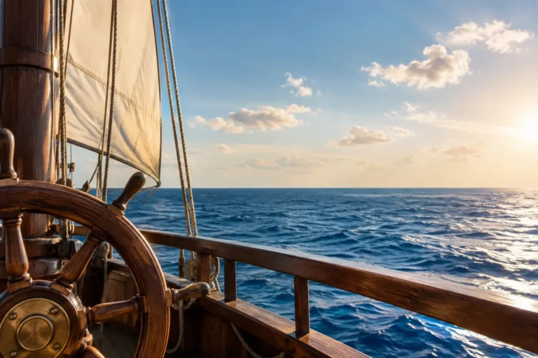
Seeing Garachico from the water offers an informative perspective on how the landscape was formed. From offshore, volcanic landforms created by the 1706 eruption remain clearly visible on the hillside above, showing where the material poured down the cliffs to create the current headlands.
However, navigating this stretch of coast requires careful planning. Unlike the calmer, sheltered waters of the south coast around Costa Adeje, the north coast of Tenerife is subject to strong winds and currents influenced by the Azores High. Boating excursions to this area depend on favourable weather windows and professional maritime judgment.
Experiencing both coasts reveals two very different sides of Tenerife:
Garachico preserved much of its early colonial character. Unlike Tenerife's principal commercial ports, it experienced relatively limited industrial redevelopment during the 19th and 20th centuries, leading to its designation as a Bien de Interés Cultural (BIC) in the Historic Site category in 1980.
Standing today at the edge of the basalt rock at El Caletón, you can look out at the open Atlantic and back toward the historic streets. Garachico lost its harbour, but it preserved its identity—rebuilding on the cooled lava and turning a historic disaster into a lasting legacy.
The 1706 eruption originated from the Trevejo volcanic vent, which is also commonly referred to as Arenas Negras, situated on the northwestern rift zone of Tenerife.
The eruption began on May 5, 1706. The main phase of lava production and the subsequent infilling of the harbour occurred over the following days of May.
No. While the eruption rendered the commercial harbour unusable and buried several residential quarters, many key historical buildings survived, including the 16th-century Castillo de San Miguel and several religious structures.
The eruption fundamentally changed the shape and depth of the bay. The basaltic lava flows poured directly into the water, altering the seabed topography (bathymetry) and making it too shallow and exposed for commercial merchant shipping to dock safely.
Following the loss of Garachico's harbour, much of the northern export trade shifted to Puerto de la Orotava (now Puerto de la Cruz). Over the long term, major shipping activity concentrated in Santa Cruz de Tenerife due to its deep-water harbour capabilities.